Isopolis Reimagines San Francisco Through Isometric Pixel Art
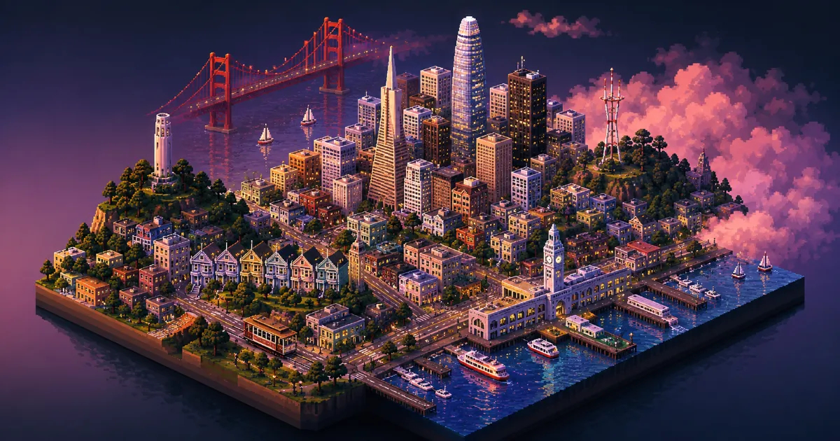
Explore the intersection of urban cartography and digital artistry with the Isopolis project, a unique pixelated visualization of San Francisco.
Mapping Urban Landscapes Digitally
Modern web mapping services have long prioritized utilitarian satellite views and rigid vector paths over artistic representation. The Isopolis project marks a distinct departure from this standard by rendering the dense, vertical complexity of San Francisco through a lens of classic isometric pixel art. By stripping away the bloat of traditional geospatial platforms, the creator focuses on the aesthetic rhythm of the city, turning navigation into an act of visual exploration rather than mere pathfinding.
At its core, Isopolis relies on a highly curated pixel grid that captures the topography of the Bay Area. Unlike platforms that require heavy real time server processing, this project leverages static rendering techniques to maintain high performance across browsers while preserving the charm of high resolution pixel art. The resulting map feels like an interactive living illustration, reminiscent of classic sim management games but anchored in the actual streets of San Francisco.
Technical Implementation and Design
The construction of Isopolis involves a meticulous approach to data layering. The project team had to translate real world coordinates into a skewed isometric projection, ensuring that the height of buildings and the slope of hills remained consistent with the visual style. This requires a custom rendering engine that balances pixel density with browser rendering limits, avoiding the common pitfalls of jagged aliasing often found in web based graphical representations.
| Feature | Isopolis Implementation |
|---|---|
| Perspective | Isometric 30 degree angle |
| Data Source | Custom Vector Overlays |
| Rendering | Canvas API and Optimized PNG Tiles |
| Interaction | Dynamic Zoom and Pan |
Community Impact and Urban Visualization
Beyond its visual appeal, Isopolis serves as a proof of concept for how developers can approach data visualization differently. By prioritizing style over absolute scale, the project invites users to interact with their environment in a way that feels curated and intentional. This shift in perspective is crucial for modern web design, where information overload often obscures the actual user experience. The project demonstrates that complex geospatial data can be presented in a way that feels organic rather than robotic.
The goal was never to replace Google Maps, but to create a space where the city feels like a character rather than a collection of navigation points. The aesthetic choices are meant to evoke nostalgia while maintaining technical accuracy regarding street layouts and district boundaries.
The Big Picture
Isopolis sits at the intersection of hobbyist web development and creative engineering. It reminds the development community that the browser is as much a canvas as it is a terminal. As we see more experimentation with unique user interfaces, projects like this highlight the value of personal passion in driving innovation across the web. Whether or not it leads to a broader trend in isometric urban mapping remains to be seen, but for now, it stands as a testament to the power of creative coding and focused execution.