
- Subject Overview: Pixxel Secures $100 Million Series C Funding to Scale Hyperspectral Earth Observation Constellation — Key developments across Startups.
- Technical Context: Detailed analysis of architectural changes, product capabilities, and engineering metrics.
- Industry Impact: Key implications for software developers, startup founders, and enterprise technology adopters.
The Hyperspectral Revolution in Earth Observation
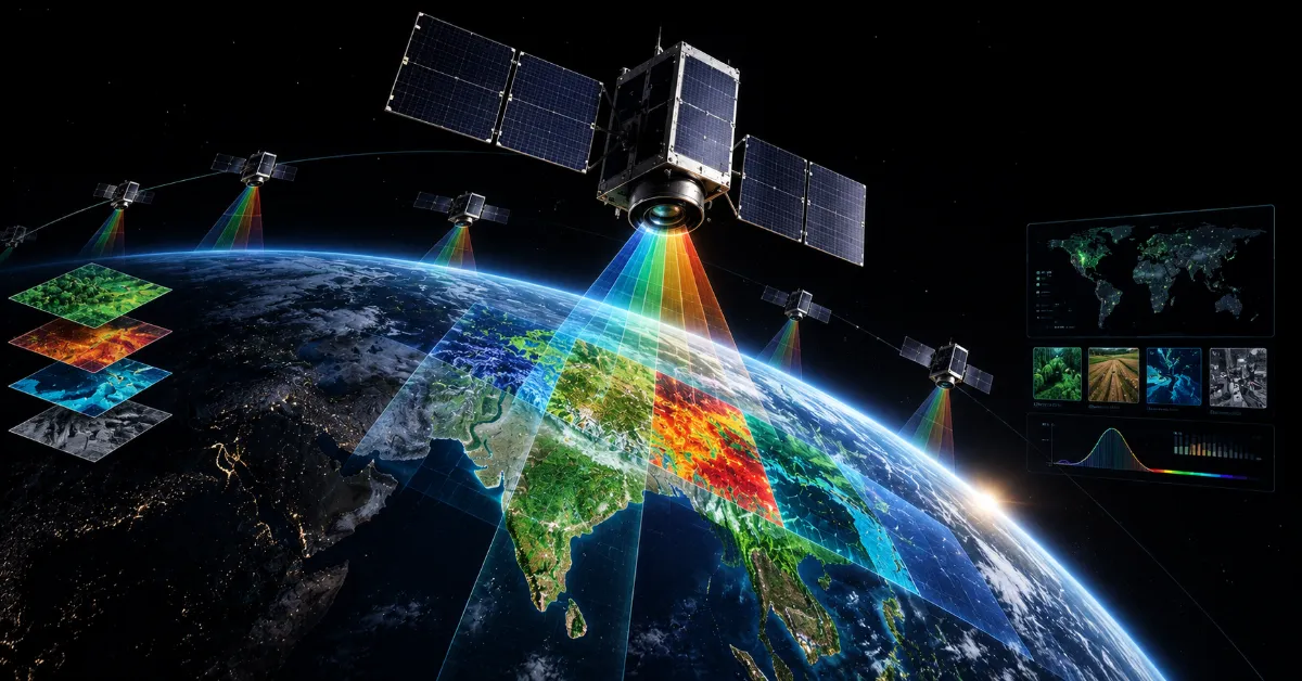
Traditional Earth observation satellites have long relied on multispectral imaging, capturing data across a handful of broad spectral bands that provide basic visual information regarding vegetation health, urban development, and meteorological phenomena. However, this conventional approach fundamentally limits scientific and commercial utility by masking subtle chemical, mineral, and biological signatures hidden within the electromagnetic spectrum. Pixxel is fundamentally transforming this paradigm by deploying advanced hyperspectral imaging satellites capable of capturing data across hundreds of contiguous narrow spectral bands simultaneously, revealing unprecedented granular insights into planetary health.
This technological leap enables enterprise customers across agriculture, mining, energy, and environmental monitoring sectors to detect methane leaks, assess soil nutrient deficiencies, monitor crop stress, and identify mineral deposits with surgical precision from low Earth orbit. By identifying unique spectral fingerprints unique to specific materials, Pixxel's platform transcends simple visual observation, delivering actionable chemical intelligence that was previously accessible only through expensive, localized ground-based spectroscopy or airborne campaigns. The recent $100 million Series C funding round, co-led by Temasek, provides the vital financial runway required to accelerate the manufacturing, testing, and orbital deployment of the company's planned satellite constellation.
Scaling a commercial hyperspectral constellation presents formidable engineering and financial hurdles, requiring rigorous component testing, precise orbital insertion tolerances, and robust ground station infrastructure to ingest terabytes of raw optical data daily. The participation of premier institutional investors underscores growing market recognition of the immense commercial value locked within space-derived environmental data as global corporations face increasingly stringent sustainability reporting requirements and ESG mandates. Pixxel's ability to attract Tier-1 capital validation confirms that hyperspectral imaging has transitioned from an experimental academic pursuit into an indispensable enterprise data category.
Satellite Architecture and Constellation Engineering
Designing and building high-performance hyperspectral satellites capable of maintaining calibration while withstanding the brutal thermal and radiation extremes of low Earth orbit demands exceptional aerospace engineering discipline. Pixxel's proprietary satellite bus architecture integrates custom-designed optical payloads engineered to maximize signal-to-noise ratios across wide swaths of the electromagnetic spectrum without compromising spatial resolution. Managing the massive data throughput generated by hundreds of spectral bands requires onboard processing capabilities and high-bandwidth X-band communication links to transmit telemetry efficiently back to ground stations.
The engineering team at Pixxel utilizes advanced computer-aided design, finite element analysis, and rigorous thermal-vacuum chamber testing protocols to ensure hardware durability throughout the multi-year operational lifespan of each spacecraft. Furthermore, optimizing the physical weight and volumetric footprint of each satellite allows the company to leverage rideshare launch opportunities effectively, reducing unit economics per kilogram to orbit and accelerating constellation deployment timelines. This agile manufacturing and deployment methodology contrasts sharply with legacy government space programs, enabling rapid iteration cycles where software and hardware improvements are continuously incorporated into subsequent satellite batches.
Data calibration represents another monumental technical challenge in hyperspectral imaging, as atmospheric interference, solar angle variations, and sensor degradation can distort spectral signatures over time. Pixxel has developed proprietary radiometric and geometric calibration algorithms that automatically correct raw sensor data against established ground reference targets, ensuring consistent, high-fidelity data products for enterprise subscribers. This automated processing pipeline is essential for scaling operations, allowing the company to ingest, correct, and publish analysis-ready imagery hours after capture rather than weeks.
Enterprise Software and Cloud Analytics Infrastructure
Hardware in orbit represents only half of Pixxel's technological footprint; the true commercial value lies in the software-defined analytics platform that transforms raw hyperspectral data into intuitive enterprise dashboards and API endpoints. Processing petabytes of multi-dimensional raster data requires distributed cloud computing pipelines optimized for geospatial analytics, machine learning inference, and high-performance raster rendering. Pixxel's engineering organization has constructed a scalable cloud-native backend capable of executing complex spectral unmixing algorithms and change-detection models across global datasets seamlessly.
Enterprise customers access these insights through intuitive web applications and robust developer APIs, integrating planetary intelligence directly into their internal geographic information systems and enterprise resource planning software. For agricultural conglomerates, this means receiving automated alerts regarding nitrogen depletion or water stress days before visual symptoms manifest on crops, enabling targeted fertilizer application and optimized yield management. In the energy sector, automated methane plume detection algorithms scan pipeline corridors continuously, helping operators mitigate environmental liabilities and comply with emerging regulatory emissions caps.
The development of these specialized machine learning models relies on extensive training datasets annotated by domain experts in geology, agronomy, and atmospheric science, bridging the gap between raw aerospace engineering and practical industry applications. As the satellite constellation grows denser, revisit rates improve, enabling near-real-time monitoring of dynamic assets such as open-pit mines, illegal deforestation sites, and maritime shipping lanes. This shift from static periodic reports to continuous geospatial monitoring represents a fundamental paradigm shift in how global industries interact with planetary ecosystems.
Strategic Market Positioning and Future Horizons
With a fortified balance sheet following the Series C financing led by Temasek, Pixxel is uniquely positioned to capture dominant market share within the rapidly expanding commercial Earth observation sector. The company plans to scale its manufacturing facilities, expand its global sales and engineering teams, and accelerate the commercialization of its advanced analytics suites across key international markets. As geopolitical tensions heighten the strategic importance of domestic space capabilities and independent environmental monitoring, sovereign governments are also emerging as lucrative enterprise customers for high-resolution hyperspectral intelligence.
The ongoing maturation of the private space ecosystem has democratized access to orbital data, but true differentiation now depends entirely on data quality, revisit frequency, and ease of software integration. Pixxel's uncompromising focus on hyperspectral technology provides a powerful competitive moat that commodity optical and synthetic aperture radar constellations cannot easily replicate. By unlocking the invisible chemical makeup of the Earth from space, Pixxel is equipping humanity with the empirical tools necessary to manage planetary resources sustainably and transparently in the decades ahead.
Ultimately, the successful capitalization and expansion of startups like Pixxel signal a broader transformation in venture capital deployment, where deep tech and space infrastructure attract sustained institutional conviction despite macroeconomic headwinds. As satellite manufacturing costs decline and cloud-based geospatial processing tools mature, the commercial applications of orbital intelligence will continue to multiply across every major global industry. Pixxel stands at the vanguard of this celestial data revolution, transforming abstract scientific observation into concrete economic and environmental value.
Related Coverage on TechRoro
- [Startups] AIR Secures $50 Million To Pioneer Autonomous Agent Security And Skill Vetting Platforms
- [Startups] Newlight Secures Seed Funding to Pioneer Hydrogen Fuel-Injection for Maritime Cargo
- [Startups] ByteDance Secures Massive 29.6 Billion Dollar Loan Facility Amid Global Expansion